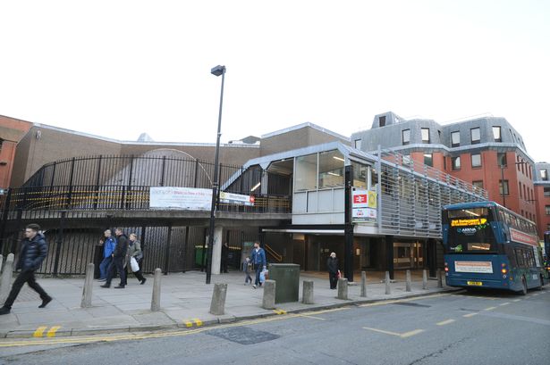
As a bustling hub for an underground rail service, Moorfields has to be one of the most unusual train stations in the country – one where passengers must go up to go down.
People travelling from Moorfields station must take a ramp or stairs up to an elevated ticket office before once again descending down multiple escalators to the platforms. This unusual feature is unique among Merseyrail stations, sparking confusion among some passengers who question the logic behind such a seemingly bizarre planning decision. But there is a reason for Moorfields' odd structure – one inextricably linked to an ill-fated network of "skyways" once championed by Liverpool Council.
Moorfields Station was built in the 1970s as a replacement for the Liverpool Exchange railway station, located just a short walk away on Tithebarn Street. Its elevated structure was intended to connect the station with a network of overhead walkways, which Liverpool Council hoped would help separate pedestrians and road traffic.
Dad on way to meet new baby killed woman as he ran through red light
I tried the iconic Scouse drink Aussie Whites and it surprised me
Known as the Shankland Plan, proposals for Liverpool's streets in the sky began in 1965, and quickly gathered steam as proponents described "a need for a network of footways penetrating to all parts of the central area" of the city. Clusters of walkways were built around the city, including around Old Hall Street and St Johns Shopping Centre, in the early 70s. However, these were not well used, and quickly became hotspots for crime – with one bridge over The Strand being nicknamed “mugger’s alley”.
By the time Moorfields opened in 1977, the £2m streets in the sky plan had already been set aside. But it was too late to alter the unique appearance of the station – and so it remained above street level. The remains of the bridge which once led from the station to Old Hall Street can still be seen today above the Old Hall Street entrance in the form of a bricked-up gap.
As the years progressed, the once highly praised skyways became regarded as eyesores, and were torn down one by one. The last of the overhead bridges, the Churchill Way flyover, was demolished in 2018 – more than two decades after the plans were officially scrapped once and for all.
Today, reminders of Liverpool's lost city in the sky can be found scattered in various places around the centre. St Johns Shopping Centre's two-storey layout dates back to the overhead network, once linking it to the bridge over Roe Street. Other walkways once connected to the network can also be seen around New Hall Place, the Atlantic Tower, and James Street.
Try the Liverpool Echo Premium app and get the first month free

